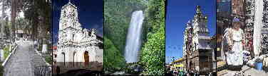
Tourism in the Machalilla National Park
Tourism in the Machalilla National Park
ESN
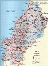
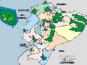
Machalilla National Park is in the province of Manabí near Puerto López on the Ecuadorian coast.
Machalilla is the town from where you can enter the park.
The Machalilla National Park has an area of 56,184 hectares, and was created on November 20, 1979 with Official Gazette 69.
Parque Nacional Machalilla
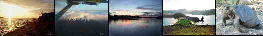
Playa de los Frailes
It is considered one of the few beaches that still maintains its natural characteristics. It is located between the towns of Machalilla and Puerto López. In this sector there is a path that runs through the dry forest and crosses the beaches of La Tortuguita and La Playita until reaching Los Frailes.
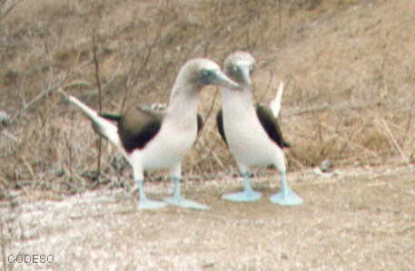
The Isla de la Plata is in front of Puerto de Cayo, but there are also boats from Puerto López to the island. On the island there are some animals and plants like in the Galapagos Islands, for example the "Blue Legs". On the boat trip to the Isla de la Plata there is in season the possibility of observing humpbacked vallenas.
Comuna Agua Blanca
It maintains an archaeological museum with pieces from the Manteño - Huancavilca culture. In this area the famous stone chairs or chairs of power have been found.
Observación de ballenas jorobadas
Another attraction is the sighting of humpback whales, present between July and September. These mammals travel from the cold Antarctic waters to our warm waters, in search of suitable conditions to reproduce and have their young. Tour operators that offer whale watching boat services, as well as visitors and tourists must follow the established rules.

Other Natural o Protected Areas and Spots
Galapagos - Llanganates - Ilinizas - Chimborazo - Sangay - Yasuni - Cuyabeno - Machalilla - Cotopaxi


Arenillas Ecological Reserve
INTERESTING SITES
Puerto López is close to the Machalilla National Park and there is a beautiful beach here. From here the boats depart to the Isla de la Plata and the humpback whale watching tours.
The Isla de la Plata is in front of Puerto de Cayo, but there are also boats from Puerto López to the island. On the island there are some animals and plants like in the Galapagos Islands, for example the "Blue Legs". On the boat trip to the Isla de la Plata there is in season the possibility of observing humpback whales.
Machalilla National Park is in the province of Manabí near Puerto López on the Ecuadorian coast.
Manta is the main port of the Manabí Province and is located in the northwest near Portoviejo.
Portoviejo is the capital of the Manabí Province and has almost 200,000 inhabitants.
Bahía de Caráquez has a nice beach. It is reached by boat or by the bridge from San Vicente in the north of Portoviejo.
Crucita
Crucita is in the northwest near Portoviejo.
San Jacinto
San Jacinto is in the north of Rocafuerte.
San Clemente
San Clemente is near San Jacinto is in the north of Rocafuerte.
Pedernales
Pedernales is on the beach in the north of the province of Manabí.
Cojimíes
Cojimíes is a beach in the extreme north of the province of Manabí.
Puerto Cayo
Puerto Cayo is in the southwest of Portoviejo.
Los Frailes
Los Frailes has a beautiful secluded beach in the southwest of Portoviejo.
Montanita
Montanita has a beach and is in the southwest of Portoviejo in the province of Santa Elena.
Montecristi
Montecristi is between Portoviejo and Manta.